Marine Navigation Equipment: Essential Guide to Safe Voyages
Marine navigation equipment helps vessels identify position, direction, depth, routes, and nearby hazards. This guide explains its importance, recent developments, regulations, useful tools, and common questions.
Marine navigation equipment includes the systems and instruments used to guide ships, boats, and other vessels safely across water. These technologies help navigators understand where a vessel is, where it is heading, and what hazards may be nearby.
Traditional navigation depended heavily on paper charts, compasses, visual landmarks, and celestial observations. Modern vessels now use advanced systems such as GPS navigation, marine radar, electronic chart display systems, automatic identification systems, and depth monitoring equipment.
The purpose of marine navigation technology is simple: improve situational awareness and support safer decision-making. Navigation equipment can help identify coastlines, shallow water, other vessels, changing routes, and important maritime boundaries.
Common Types of Marine Navigation Equipment
| Equipment | Main Navigation Function |
|---|---|
| GPS and GNSS | Determines vessel position |
| Marine Radar | Detects vessels, land, and objects |
| ECDIS | Displays electronic navigational charts |
| AIS | Shares vessel identity and movement data |
| Gyrocompass | Provides accurate directional information |
| Echo Sounder | Measures water depth |
| Autopilot | Helps maintain a selected course |
Why Marine Navigation Equipment Matters Today
Marine navigation equipment affects commercial shipping, fishing vessels, passenger vessels, research ships, ports, and recreational boating. Modern maritime activity involves crowded waterways and complex routes, making accurate navigation increasingly important.
One major challenge is avoiding collisions. Radar and AIS can provide information about nearby vessel movement, while electronic charts help navigators understand route conditions. Depth monitoring equipment is also important in shallow or changing waters.
Modern navigation systems can also support fuel-efficient route planning and operational efficiency. Accurate route information may help vessels avoid unnecessary deviations while considering weather, currents, restricted areas, and navigational hazards.
Key Benefits for Maritime Operations
- Improved vessel position awareness
- Better identification of nearby traffic
- Greater awareness of route hazards
- Support for electronic chart management
- Improved communication between vessels
- More accurate course and depth information
Technology does not replace trained human judgment. Equipment may experience signal interruptions, technical faults, incorrect settings, or inaccurate data inputs. For this reason, navigators must understand both electronic systems and traditional navigation principles.
Recent Updates and Trends
During 2025 and 2026, maritime navigation has continued moving toward greater digital integration. Electronic navigational charts, connected bridge systems, improved satellite navigation, and cybersecurity awareness have remained important areas of development.
The transition toward updated electronic chart standards has also continued across the maritime sector. Newer digital chart formats are designed to support more detailed data and improved information management for modern navigation systems.
Another major trend is the growing focus on cybersecurity. As ships become more connected, navigation and communication systems require stronger protection against unauthorized access, data manipulation, and technical disruption.
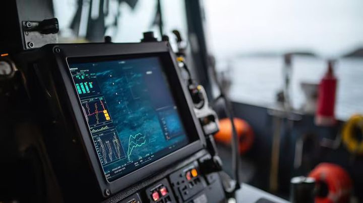
Automation is also expanding. Integrated bridge systems can combine radar, charts, positioning, alarms, and vessel data into a more unified operational view. However, human oversight remains essential, particularly in congested waters or unusual conditions.
Laws and Policies Affecting Marine Navigation
Marine navigation equipment is influenced by international maritime rules and national regulations. Requirements may differ according to vessel type, size, operating area, and voyage category.
International maritime safety frameworks establish standards for navigation equipment, bridge operations, collision prevention, and safety procedures. Many vessels are required to carry specific equipment or maintain systems according to approved technical standards.
Important regulatory areas include:
- International collision prevention rules
- Electronic chart carriage requirements
- AIS equipment requirements for applicable vessels
- Navigation safety equipment standards
- Radio and satellite communication requirements
- Flag-state and port-state inspection rules
National maritime authorities may also issue additional requirements. Vessel operators should check the rules applicable to their registration and operating waters.
Useful Tools and Resources
Several general resources can support navigation knowledge and voyage preparation without replacing professional judgment.
Helpful Navigation Resources
- Electronic and paper navigational charts
- Marine weather forecasting platforms
- Tide and current calculators
- GNSS position tools
- Distance and bearing calculators
- Route-planning templates
- Navigation checklists
- Maritime safety training materials
- Official notices for chart and route updates
A practical navigation checklist can include equipment checks, chart updates, route verification, weather review, communication readiness, and backup navigation procedures.
Frequently Asked Questions
What is the most important marine navigation equipment?
GPS or GNSS is widely used for position information, but safe navigation normally depends on several systems working together, including charts, radar, AIS, and depth monitoring.
What is the difference between GPS and AIS?
GPS determines a vessel's geographical position. AIS transmits and receives identification, position, course, and movement information from equipped vessels.
Can electronic charts replace navigation skills?
No. Electronic charts provide valuable information, but navigators still need proper training, situational awareness, and the ability to respond when technology is unavailable.
Why is marine radar important?
Marine radar helps detect land, vessels, and other objects, especially when visibility is limited by darkness, rain, fog, or distance.
How often should navigation information be updated?
Charts, navigation data, and route information should be reviewed regularly and updated according to applicable maritime requirements and voyage conditions.
Conclusion
Marine navigation equipment plays a central role in modern maritime safety. GPS, radar, ECDIS, AIS, compasses, and depth systems provide different types of information that help navigators understand their surroundings and make informed decisions.
As maritime technology becomes more digital and connected, accurate data, proper maintenance, cybersecurity, and human expertise are becoming increasingly important. A balanced approach that combines modern equipment with strong navigation knowledge supports safer and more reliable voyages.
Disclaimer: This article is for general educational purposes only. Marine navigation requirements vary by vessel type, location, and applicable maritime regulations. Readers should follow current official guidance and qualified professional procedures when making navigation-related decisions.